Buying
Flood Zones in Ponte Vedra, Explained: What Buyers Need to Know
By Mollie Younger September 22, 2026 6 min read
VE, AE, and X decide your flood insurance. Here is what each letter means around Ponte Vedra, what drives the premium, and how to check an exact address before you offer.
Let me be direct: the flood zone is the most address-specific number in a coastal purchase, and it is almost always the last thing explained before the offer. I run every relocating family through this before we write anything, because the surprise is never the house. It is the policy, the elevation, and the map that decides both. This guide covers what the letters mean, where they show up around Ponte Vedra Beach and Nocatee, and exactly how to check the address you are considering.
What the letters actually mean
FEMA maps the floodplain in risk zones, and each letter is a risk level, not a mystery code. Zone A is high risk, a 1% annual chance of flooding, the floodplain people still call the 100-year zone, where FEMA has not yet set a precise Base Flood Elevation. Zone AE is the same 1% risk with the detailed study done, so there is a Base Flood Elevation that builders, lenders, and insurers all use. Zone VE is the coastal high hazard area: the 1% chance plus storm surge and wave action, think waves three feet or higher pushing against the structure. Zone X is outside the 1% floodplain, moderate to low risk, and shaded X marks the 500-year floodplain with a 0.2% annual chance. The practical gap between them is insurance: required in A, AE, and VE when there is a federally backed mortgage, strongly recommended everywhere else.
Where the zones show up around here
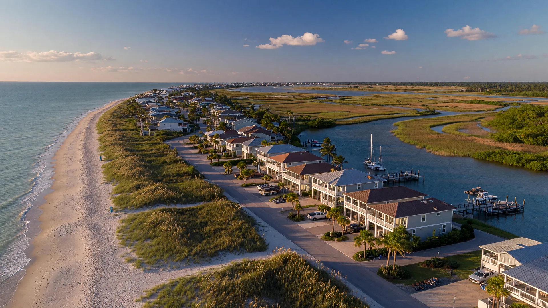
The pattern follows the geography. The Atlantic-facing oceanfront blocks of Ponte Vedra Beach, the dune lines and the lots that touch them, are mapped in VE, the highest-risk zone. Homes near the marshes, tidal creeks, and the Intracoastal Waterway sit in AE. Most homes west of A1A are in Zone X, and most of Nocatee is in Zone X too, because the master plan graded and engineered the land for drainage from day one. Two houses two neighborhoods apart can sit in different zones. The map decides, not the ZIP code and not the neighborhood name.
Flood insurance is separate, and it may be required
Your homeowners policy does not cover flood damage. In Florida, flood is always its own policy, written through the National Flood Insurance Program or a private carrier. If a home sits in an A, AE, or VE zone and you have a federally backed mortgage, flood insurance is mandatory and your lender will enforce it. The rules are also tightening: Florida's insurer of last resort, Citizens, now requires flood coverage alongside its wind policies, from 2026 for homes with more than $400,000 in dwelling coverage and for every Citizens policy, even in Zone X, starting in January 2027.
What actually drives the premium
- The zone: VE, AE, and X set the baseline risk tier.
- Elevation: the height of the lowest floor relative to the Base Flood Elevation is the biggest lever after the zone. An elevated home in a VE zone can quote far more reasonably than a slab home in the same block, which is exactly why coastal construction here sits on pilings.
- The policy choices: your deductible, whether you cover contents, and whether you buy through the NFIP or a private-market carrier.
- Map history: newer FEMA maps can move a home into a different zone than the one it was built under, which is one reason an Elevation Certificate matters.
How to check an exact address before you fall in love
You do not need an agent to read the map, and you should check the address before you get emotionally attached. FEMA's Flood Map Service Center lets you search any street address against the official flood maps. St. Johns County runs its own Flood Zone Viewer through the county GIS portal, where you can see the zone and the Base Flood Elevation for a parcel. If the home has carried flood insurance before, the current owner or your lender can request the prior Elevation Certificate, and the county's Floodplain Management Team at (904) 827-6800 can answer questions and provide file copies. The Elevation Certificate form, FEMA Form FF-206-FY-22-152, is completed by a licensed surveyor or engineer and is the document that settles the real cost.
The honest buyer's takeaway
A flood zone is information, not a verdict. A VE designation on an oceanfront lot means the home should be elevated, insurance is a real line item, and every future buyer already understands both facts. A Zone X home in Nocatee still benefits from a flood policy, because the cheapest insurance is the policy you never file a claim on. The families who love living here knew the numbers before the offer. The ones who feel trapped found them out after. I want you to understand the why on the front end.
Flood insurance is one line in a bigger coastal cost picture. The hidden costs guide walks through the rest of the list, and the community comparison shows how the risk pattern shifts from oceanfront Ponte Vedra Beach to inland Nocatee.
Mollie says
Here is the thing: before you write an offer, send me the address. I will pull the flood map, talk through what the zone and elevation mean for your premium, and tell you the truth about whether this home is priced for the risk it carries. The right move, not just any move.

Written by
Mollie Younger
Ponte Vedra real estate advisor, dual-state broker, mother of a relocated family. 25+ years in real estate, 400+ homes sold. She sees the whole move, not just the house.
About MolliePlanning a move to northeast Florida?
Bring me your situation and I'll bring you the truth: which communities fit, what the budget math looks like, and how the whole move comes together.